20-Day Itinerary for the John Muir Trail

In September 2020, I got evacuated from the John Muir Trail 5 days and 60 miles in due to wildfires. I was devastated but knew I’d be back to finish what I started.
In February 2021, I scored another golden ticket. 2021 was my second chance.
On September 4, 2021, I summited Mt. Whitney on my final day of the JMT.
This is my 20-day southbound John Muir Trail itinerary.During my trip, I deviated slightly from my planned itinerary since I was taking too many snack breaks, forever to break down camp, and long photoshoots at each jaw-dropping view. My permit started in Happy Isles in Yosemite (the true start of the trail) and included three resupply stops and a 2-day detour to Vermillion Valley Ranch. I averaged about 13-15 miles per day which was the perfect pace for a first-time thru-hiker. It was the perfect amount of challenge where I could still enjoy my time.
In the itinerary below, I provide the number of miles I hiked that day, total JMT miles, elevation gain, campsite, and any other additional information. I used the app FarOut to track the entire trip (HIGHLY RECOMMEND) so the mileage corresponds to that. FarOut is also key to see where you can fill up water and where you can/cannot camp. The comments on the app update in real time even without service, which is helpful to see any obstacles or dry water sources.
I’ve also marked each resupply on the itinerary. I chose to resupply at Reds Meadow, Muir Trail Ranch, and Onion Valley. With 3 resupply points I never carried more than 6 days of food. I also chose to detour to Vermillion Valley Ranch to take 2 half-days off (nearly zero, known as “nero” in thru-hiking parlance). It was so worth the extra miles for their showers, food, hospitality, and hiker community. Check out Resupply Strategy on the John Muir Trail for additional information on each point.
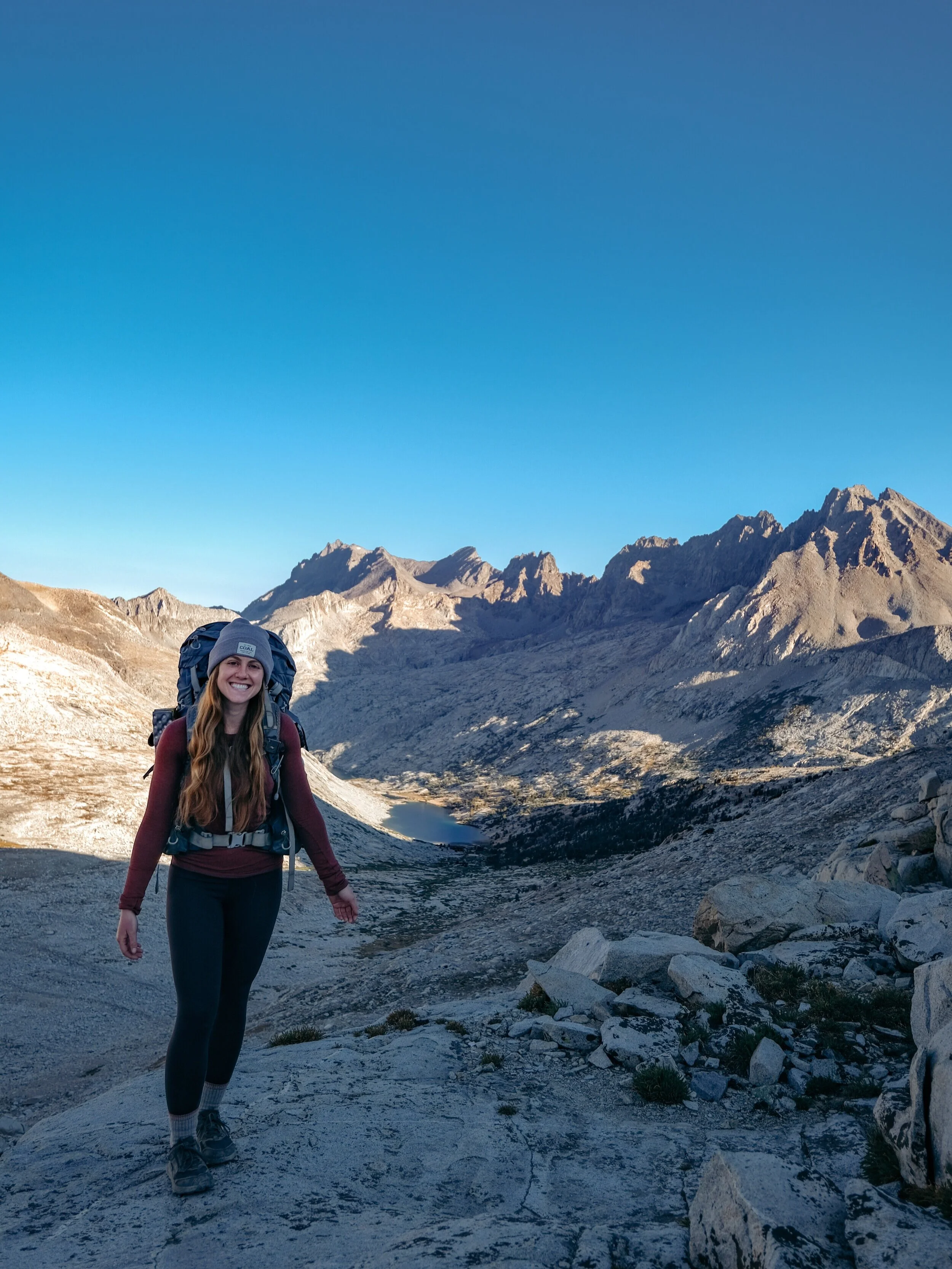
My 20-Day Itinerary
Day -2 and -1 (before your start date): Mammoth Lakes, California
Mammoth Lakes is at 7,500 - 8,000 ft. elevation which makes it the perfect place to acclimate to altitude. Go on a short day hike (2-3 miles) while staying in Mammoth.

Short day hike in Mammoth Lakes, California
Day 0: Mammoth Lakes to Happy Isles, Yosemite National Park
Check out Everything You Need to Know When Planning the John Muir Trail to learn about transportation options and where to park.
Campsite: Backpacker’s Campground in Yosemite National Park
The campground is located directly next to the Happy Isles trailhead. It costs $6 per person for the night. Cash or credit card accepted!
Day 1: Happy Isles to Sunrise Creek
Miles: 13
JMT Miles: 10.4
Elevation Gain: 4,500 ft. gain
Campsite: Sunrise Creek
The climb out of the valley is brutal but well worth it for the views. It is a long, hard first day. I stopped a little before Sunrise Lakes to set up camp. Depending on the time of year, there are very limited water sources in this area so be sure to check on this before your trip.

Climbing out of the valley in Yosemite National Park.
Day 2: Sunrise Creek to Tuolumne Meadows
Miles: 15
JMT Miles: 23.3
Elevation Gain: 2,500 ft. gain
Campsite: Tuolumne Meadows
After a short and steep morning climb, you’re rewarded with an easy downhill and beautiful meadows. Cathedral Lakes is the perfect place to stop for lunch (one mile detour).
There’s no camping within 4 miles of Tuolumne Meadows so you must reach their backpacker’s campground that night. The campground costs $6 per person for the night. Cash or credit card accepted!

Lunch break at Cathedral Lake
Day 3: Tuolumne Meadows to Lyell Canyon
Miles: 15
JMT Miles: 34.4
Elevation Gain: 2,000 ft. gain
Campsite: Lyell Canyon Fork
The trail is mostly flat all day until you start climbing Donahue Pass. I highly recommend camping at the second “Lyell Fork,” at mile 34.4, so you’re closer to the base of Donahue Pass. It’s the perfect place for an alpine swim and has tons of available campsites.

Next to my campsite at Lyell Fork
Day 4: Lyell Canyon to Rosalie Lake
Miles: 16
JMT Miles: 48.3
Elevation Gain: 2,500 ft. gain
Campsite: Shadow Creek Junction
You’ll climb over Donahue and Island Pass (great place for a lunch break) as well as hike around Thousand Island and Garnet Lake. It’s a long day! My original plan was to camp at Rosalie Lake but I was tired and hungry and ready to be done for the day so I stopped at Shadow Creek Junction. There are many campsites and incredible sunset views.

View of Thousand Island Lake
Day 5: Rosalie Lake to Reds Meadow (RESUPPLY)
Miles: 11.5
JMT Miles: 59.5
Elevation Gain: 1,500 ft. gain
Campsite: Reds Meadow
Resupply at Reds Meadow. For more details check out Resupply Strategy on the John Muir Trail. You can camp at their backpacker’s campground ($23/night) or you can book a cabin through the resort. There are also shuttles into Mammoth ($20 round trip), if you prefer to stay in town. It’s a great place to take the afternoon off to enjoy a shower, hot meal, and some rest.
Day 6: Reds Meadow to Purple Lake
Miles: 14
JMT Miles: 72.6
Elevation Gain: 3,050 ft. gain
Campsite: Purple Lake
The entire day is a gradual uphill with minimal views (it was a very smoky/hazy day for me so that may be why haha). I originally planned to camp at Lake Virginia but ultimately decided to stop a little early at Purple Lake instead. Once you arrive at the lake, take the Ram Trail to find many amazing campsites that overlook the lake.

Sunset at Purple Lake
Day 7: Purple Lake to Mono Creek
Miles: 14
JMT Miles: 88.1
Elevation Gain: 2,500 ft. gain
Campsite: Mono Creek
The day begins with a climb up to Lake Virginia – beautiful views and sparkling water. You’ll then start the hike up Silver Pass which isn’t too challenging if you split it up. After about 1000 ft., you’ll reach Squaw Lake – the perfect place for lunch and an afternoon swim. The remaining climb up and over the pass isn’t too difficult and is so rewarding.
The last 6 miles of the day is a long descent into Mono Creek. I’m not sure what it was, but this was one of those downhills that make you question if you like downhills more than uphills.

Near the top of Silver Pass
Day 8: Mono Creek to Vermillion Valley Ranch (afternoon “nero”)
Miles: 7.5
JMT Miles: 88.1
Elevation Gain: 1,000 ft. gain
Campsite: VVR
I chose to take a 2-day detour to Vermillion Valley Ranch (VVR) after so many people recommended it. It was more amazing than I could have imagined and so worth the extra miles. You’ll be greeted with a free drink and can enjoy laundry, a shower, hot food, hiker boxes, and tons of new trail friends.
The trail to VVR from Mono Creek wraps around Edison Lake for 7 miles. Most years, there’s a ferry that shuttles hikers across the lake. Unfortunately, the water levels were too low for it run this year so I took the trail.
For more information about VVR amenities and resupply, check out Resupply Strategy on the John Muir Trail.
Day 9: Marie Lake to Muir Trail Ranch (afternoon “nero”)
Miles: 7.5
JMT Miles: 88.1
Elevation Gain: 1,000 ft. gain
Campsite: Mono Creek
There are a few options to get back to the John Muir Trail from VVR. If you don’t want to miss any JMT miles (like me), take the Mono Creek Trail the same way you came in. If you don’t mind missing about 4 miles of trail and want to skip about a 2000 ft. climb, take the Bear Ridge trail back.
Day 10: Mono Creek to Marie Lake
Miles: 14
JMT Miles: 101.4
Elevation Gain: 3,500 ft. gain
Campsite: Marie Lake
Wake up early to get the climb done before the heat of the day – 2000 ft. gain in the first 4 miles. The trail is mostly exposed after the climb but you’ll reach Bear Creek, which is the perfect place for lunch and soaking your feet. Once you reach Marie Lake, keep hike a quarter mile beyond the lake to reach the rocky outcrop overlooking it. There are tons of epic campsites here…thank me later.
This is also a day to celebrate how far you’ve come – 100 miles. That’s a lot of miles!

100 JMT miles done!
Day 11: Marie Lake to Muir Trail Ranch (RESUPPLY)
Miles: 11
JMT Miles: 109.7
Elevation Gain: 500 ft. gain
Campsite: Muir Trail Ranch
The day starts with a short climb up and over Selden Pass – look back at Marie Lake from the top and you’ll be blown away by the views. The remaining hike to Muir Trail Ranch (MTR) is easy but make sure to fill up on water at Sallie Keys Lakes as there are no other places to fill up.
There are 2 junctions that lead into MTR. Make sure to take the first one as it’ll save you an extra 1.5 miles (I took the wrong one, of course). After resupplying at MTR, check out the natural hot springs and find camping right next to the ranch. It’s worth taking the afternoon off to enjoy some time here.
For more details on resupplying at Muir Trail Ranch, check out Resupply Strategy on the John Muir Trail.

Views from the top of Selden Pass
Day 12: Muir Trail Ranch to Evolution Lake
Miles: 18
JMT Miles: 124.2
Elevation Gain: 3,200 ft. gain
Campsite: Evolution Lake
This entire day is a gradual(ish) uphill to Evolution Lake. It starts with a hike along a beautiful river and past amazing waterfalls, then crosses into Kings Canyon National Park. McClure Meadows is a perfect stop for lunch before the final 5-mile climb.
Evolution Lake is stunning and full of wonderful campsite options. I highly recommend taking an alpine dip and waking up for sunrise. Trust me, you won’t regret it.

Heading into Evolution Basin
Day 13: Evolution Lake to Kings River Fork
Miles: 18
JMT Miles: 140.4
Elevation Gain: 1,200 ft. gain
Campsite: Kings River
This is the day you cross Muir Pass and finally reach the Muir hut that you’ve seen in a million pictures pre-trail. The southbound hike up isn’t too bad, but the descent is rough. It’s extremely rocky and exposed. There aren’t too many spots to stop for lunch but be sure to find somewhere with good shade!
As you head into Le Conte Canyon, there are tons of places to camp. I chose to go as far down as possible so that I could start the next climb first thing in the morning.

Muir hut at the top of Muir Pass
Day 14: Kings River Fork to Upper Palisades Lake
Miles: 9.5
JMT Miles: 148.5
Elevation Gain: 3,000 ft. gain
Campsite: Upper Palisades Lake
The day of the famous Golden Staircase – lots of gain and switchbacks! It’s not as bad as you think, but definitely a climb. Once you reach Lower Palisades Lake, take a swim break. It’s crystal clear and so refreshing. The final push of the day is up to Upper Palisades Lake. There are a few good camping spots that overlook the lake but ultimately you’re very far from the water (the nearby creek is your water source for the night).
Day 15: Upper Palisades Lake to Sawmill Pass Trail
Miles: 18.5
JMT Miles: 164.8
Elevation Gain: 3,300 ft. gain
Campsite: Sawmill Pass Trail
Two passes over 12,000 ft. in one day sounds crazier than it actually is. You’ll cross over Mather Pass, descend into the valley, then finally climb up and over Pinchot Pass. It’s a long day but full of incredible views and stunning alpine lakes. There aren’t tons of camping options but I found a little spot near a creek at the Sawmill Pass Trail junction. It wasn’t the best though – extremely windy and full of sap, but it worked.
Climbing over Mather Pass
Day 16: Sawmill Pass Trail to Kearsarge Pass Trail
Miles: 19
JMT Miles: 179.4
Elevation Gain: 3,500 ft. gain
Campsite: Kearsarge Pass Trail
You’ll start your day with a sketchy suspension bridge crossing before the long, hot climb up to Rae Lakes. The lakes are the perfect place for lunch and a swim. You’ll then cross Glenn Pass which is extremely rocky. Make sure to watch each step so you don’t roll your ankle!
I found camping 1.5 miles into the Kearsarge Pass Trail which was perfect for an early morning hike over Kearsarge Pass to resupply.

At the top of Glenn Pass
Day 17: Kearsarge Pass Trail to Vidette Meadows (RESUPPLY)
Miles: 18
JMT Miles: 181.6
Elevation Gain: 4,000 ft. gain
Campsite: Vidette Meadows
The hike up and over Kearsarge Pass twice in one day to get to and from the resupply definitely isn’t easy. I’d recommend leaving your camp set up and hiking over with an empty backpack or leaving your bear canister behind filled with heavy items. For more information about resupplying at Onion Valley, check out Resupply Strategy on the John Muir Trail.
I chose to push all the way to Vidette Meadows so that I was closer to the start of the climb up Forrester Pass for the next day. There are other camping options earlier if you chose to not go as far.
Day 18: Vidette Meadows to Tyndall Creek
Miles: 15
JMT Miles: 194.2
Elevation Gain: 3,570 ft. gain
Campsite: Tyndall Creek
Today is your climb up Forrester Pass. It’s a long and challenging climb but you’re rewarded with stunning views the entire time. There’s a creek about halfway up that’s perfect to fill up water and eat lunch.
The descent down to Tyndall Creek is long but pretty easy.

Views while climbing up Forrester Pass
Day 19: Tyndall Creek to Guitar Lake
Miles: 13
JMT Miles: 205.8
Elevation Gain: 2,100 ft. gain
Campsite: Guitar Lake
This is your “easy” day before your Mt. Whitney summit. You’ll pass the 200-mile mark (almost to the end!) before arriving at Guitar Lake. Try to find a place to camp with minimal wind as it definitely picks up throughout the night. I was able to find a little cave that was perfect for “cowboy” camping (without setting up a tent)!
Day 20: Guitar Lake to Whitney Portal
Miles: 19
JMT Miles: 221
Elevation Gain: 3,500 ft. gain
I highly recommend summiting Mt. Whitney for sunrise. It’s more than worth it. My alarm was set for 1:15AM and I started hiking right before 2AM. It was extremely windy and cold so bundle up! When you reach the junction, either drop your full pack and take the essentials or leave your bear canister filled with as many things as possible.
When you arrive at the summit, take it in. You did. You freaking did it. This is it. I sat there with a frozen Snickers in hand tearing up at the beautiful sunrise in front of me from the highest point in the continental US.
The final descent into Whitney Portal is long. Extremely long. I wasn’t expecting it but it also gave me some final time to process the life-changing experience I just accomplished.

Sunrise on top of Mt. Whitney!
I hope this helps to plan your perfect John Muir Trail adventure. Please reach out with any questions. Happy Trails!